- Sustainability
- Our Activity
- Future Stories Vol. 4 Remote Sensing
Innovation that changes the future
Future Stories Vol. 4
Remote Sensing
Protect Daily Life Through Satellite Data! What is LIANA?
Share this article
“Future Stories” is a series in which we interview Group employees about initiatives that will lead to a future with Space for your Smile.
In recent summers, natural disasters such as heavy rains and tornadoes have caused massive damage throughout Japan. The impact of natural disasters caused by climate change is increasingly being felt by everyone. Landslides and flooding caused by heavy rains that occur simultaneously in multiple locations over a wide area have become major social problems in Japan.
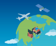
SKY Perfect JSAT Corporation uses data from satellite images of the Earth and AI technology to quickly detect with high accuracy the extent of damage caused by these natural disasters, and then utilizes this information for disaster prevention and mitigation.
Together with Zenrin Co., Ltd. and Nippon Koei Co., Ltd., we have released LIANA, a service that monitors with millimeter precision the deterioration over time of earth structures and infrastructure such as slopes and embankments.
We spoke with team members about how LIANA and other remote sensing technology and services are contributing to solving environmental and social issues.
―――Interviewee

From left: Togawa, Nishizawa, Tomihara, Anahara, Makio
- Sky Perfect JSAT Corporation
Space Business Unit
Space Intelligence Business Division - Ayaka Tomihara
- Sky Perfect JSAT Corporation
Space Business Unit
Space Intelligence Business Division - Takuma Anahara (Chief Scientist)
- Sky Perfect JSAT Corporation
Space Business Unit
Space Intelligence Business Division - Kenya Togawa
- Sky Perfect JSAT Corporation
Space Business Unit
Space Intelligence Business Division - Takahiro Makio
- Sky Perfect JSAT Corporation
Space Business Unit
Space Intelligence Business Division - Hayato Nishizawa
Current initiatives for materiality KPIs
―――One of the Group’s materiality themes is “promoting innovation which contributes to the environment and society.” Could you please introduce the initiatives you are implementing by using satellites that are high above and far away in space (remote) to measure the Earth (sensing)?
Tomihara: There are three initiatives which utilize remote sensing. The first is ascertaining the situation of flood damage, the second is slope infrastructure monitoring (LIANA), and the third is reservoir monitoring.
Specifically, when conducting remote sensing, images are acquired by low orbit satellites equipped with sensors. We procure the images, apply analysis algorithms, and provide them to our customers in the form of solutions.

Of these three initiatives, we are placing the greatest focus on LIANA. LIANA, which is an acronym for “Land-deformation and Infrastructure ANAlysis,” is a service that uses satellites to monitor the risk of deformation of slopes and infrastructure. In LIANA, “land-deformation” refers to changes in slopes, “infrastructure” refers to construction facilities such as bridges and roads, and “ANAlysis” is, of course, analysis. We use SAR satellite (a satellite that uses microwave reflection to observe the Earth’s surface from space) technology to analyze these facilities and then deliver information to our customers.
LIANA is being operated in collaboration with Zenrin Co., Ltd. and Nippon Koei Co., Ltd. Zenrin Co., Ltd. is a company that provides information such as map databases, while Nippon Koei Co., Ltd. is Japan’s largest construction consultant.
Customers can view the UI on the internet. For example, point cloud data in the mountains indicates land that requires constant monitoring, such as landslide warning areas and embankments. The customer sets the area which they want to view. We then procure and analyze satellite images and SAR satellite images, and display the analysis results as a point cloud on this UI.

The “slope deformation rank” visible on the screen alerts users to the extent of danger posed by slope movement. An alert is displayed based on standards issued by the Ministry of Land, Infrastructure, Transport and Tourism. Clicking on each point will display a graph that plots deformation from past to present. As you can see, the point clicked in this example has moved by approximately 10 centimeters over the past few years. Even in situations where it is difficult for the customer to make decisions on their own, we are able to provide advice based on the knowledge and know-how of Nippon Koei Co., Ltd.
Maps can be replaced not only with aerial photographs but also with maps made by Zenrin Co., Ltd. This allows users to see at a glance the kind of houses and facilities which are characteristic to the surrounding area, to ascertain the characteristics of the land.
Anahara: The black and white image on the left is the radar satellite image. Microwaves are aimed at the ground, and the reflection of the microwaves is shown in black and white. Similar to an X-ray photograph, the microwaves can penetrate clouds and even some walls. Even on cloudy days, the ground underneath the cloud cover can always be seen. The image on the right shows the amount of subsidence. Areas with greater subsidence are shown in blue. In the case of residential areas, this information also affects the property value.

The actual images that can be taken are much wider, with a scale of 50 kilometers x 50 kilometers. It is possible to photograph an area which fits all of Tokyo in a single shot. The observation time is approximately 7 seconds. This system informs the user of which houses in Tokyo are in danger in 7 seconds.
Using this technology to observe a slope is useful for managers in charge of that mountain slope. It is very difficult to travel deeper into the mountains. I experienced a bit of mountain climbing with Nippon Koei Co., Ltd., and it was quite challenging.
Tomihara: I gave up around the second station on the mountain slope.
Anahara: It is difficult to go into the mountains and investigate. However, using satellites makes it possible to measure everything in a few seconds. This gives it great potential for applications. This is useful when labor shortages exist and can also be applied to dangerous places.

Tomihara: In the traditional method, a surveyor needs to travel on-site to conduct the survey. When we tried to place surveying equipment on mountains, we were only able to observe one ridge, despite attempting to survey a broad area. This made it difficult to ascertain deformation across the entire area. However, using SAR satellites and remote sensing technology makes it possible to cover the entire surface (all points) of a 50 kilometer x 50 kilometer area.
In 2021, there was a large-scale landslide in Atami after heavy rains. By using our technology, managers of embankments will be able to prevent such disasters. The technology also makes it possible to ascertain the extent to which a landfill has subsided and the asset value of the landfill. For power companies, it is possible to ascertain the extent to which equipment has aged and the order in which to perform maintenance. We hope that this information will be used by customers in deciding where to invest.
―――How is LIANA commonly used now?
Tomihara: Verification has begun at a power company. The company has large hydroelectric power generation facilities in the mountains, and it requested that we monitor the nearby mountain slopes. In local governments, LIANA is used by departments that manage mountain slopes and landslide-prone areas.
Since the technology excels at providing information about land surfaces, we hope that it will be used by large construction consultants as well as real estate agents in urban areas.
―――What are the strengths of LIANA?
Tomihara: The strengths are the advanced analysis and the easy-to-use UI.
Togawa: Locations that are sinking more strongly are displayed in colors such as blue. Users can also use graphs to visually check the extent of change going back into the past. This enables detailed visualization of the information which customers want to know.
Furthermore, our partner Zenrin Co., Ltd. possesses a wealth of map data which displays detailed information such as whether a building is a housing complex or a condominium, the number of floors, the age of the building, the number of rooms, and the number of households. Moving forward, we would like to incorporate this information into LIANA and significantly increase the number of convenient functions.
―――Is it possible to inspect a personal residence?
Tomihara: Yes, it is. In fact, employees have used LIANA to check that condominiums which they recently purchased are built on safe ground.
Togawa: Actually, the area where I live happened to be within the analysis range. Analysis showed that there was no ground movement.

―――You might be able to provide the data to management association of condominium so that they can declare that their property is safe!
Contributing to the environment and society
―――Do you ever think about contributing to the environment and society from the perspective of sustainability?
Makio: We were aware that there was a shortage of surveyors and that surveying in difficult-to-reach areas would be labor-intensive and costly. Therefore, by taking advantage of the wide-area coverage provided by satellites, LIANA can be used for low-cost surveying and for checking continuous changes based on data accumulated since 2014. By having LIANA used to analyze disaster-prone areas, real estate, urban development, and other areas, I believe that it will be possible to resolve the social issues mentioned above.
Tomihara: Working with our partners Zenrin Co., Ltd. and Nippon Koei Co., Ltd. has given us insights that we could not have obtained on our own. This is also in line with the SDG No. 17, “Partnerships for the Goals.”

―――What are LIANA’s future challenges?
Togawa: We are currently receiving a lot of feedback from customers who request new functionality and improved performance. I will keep this feedback in mind when developing applications. There is data other than satellite data that impacts landslides on slopes. I would like to combine such information to create an even better service.
Nishizawa: In addition to LIANA, our goal is to create several more sustainable services that resolve social issues, and that are sought after by customers and sell well.

(Interview held on April 5, 2023)
The LIANA service enables wide-area and low-cost monitoring during normal times, thereby reducing anxiety about disasters and contributing to safe urban development. Moving forward, we aim to expand sales that target domestic local governments, infrastructure companies, and other organizations.
Related Links:
Zenrin Co., Ltd.: Top Page | Zenrin Co., Ltd. (zenrin.co.jp)